Wrightsville Borough
-1
archive,category,category-wrightsville-borough,category-59,cabin-core-1.1,select-theme-ver-3.3,ajax_fade,page_not_loaded,,smooth_scroll,big_grid,wpb-js-composer js-comp-ver-6.4.1,vc_responsive

Wrightsville Borough

York County Lincoln Highway Project

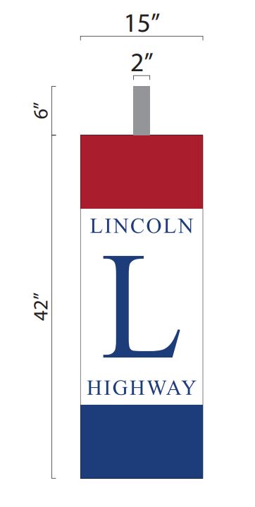
The Lincoln Highway Legacy LLC is excited to announce the next phase of our Lincoln Highway sign project across York County, Pennsylvania. We have completed our permitting process with PennDOT and new sign design. Now we're ready to accept sponsors to install over 40 Lincoln...

Highpoint Scenic Vista & Recreation Area

York County Park with spectacular views of the Susquehanna River and surrounding area. Part of the Mason-Dixon Trail System. Nice location for a family picnic or to fly a kite. Information on York County Parks and Recreation programs is available here....

September 11th National Memorial Trail

The September 11th National Memorial Trail is a multi-use route linking the nation's three 9/11 commemorative sites at the World Trade Center, Pentagon, and the Flight 93 Memorial while celebrating freedom, resilience, and history throughout the communities along its 1,300 miles. Across York County, the route follows...

Springettsbury Manor – State Historic Marker

Springettsbury Manor - Pennsylvania Historical Museum Society - State Historic Marker Dedicated: Monday, November 20, 1950 County: York Marker Type: Roadside Categories: Buildings & Architecture, Government & Politics 17th Century, Mansions & Manors, William Penn GPS Coordinates: LNG: -76.53782, LAT: 40.02397 Location: Hellam Street (PA 462), at Fairview Cemetery, Wrightsville Marker Text: Established by warrant of June, 1772; resurveyed in 1768. Extending...

State Historical Marker – Lincoln Highway

The only state historical marker commemorating the Lincoln Highway in Pennsylvania. Pennsylvania Historical Museum Commission Dedicated: Tuesday, October 7, 2003 County: Lancaster Marker Type: Roadside Categories: Business & Industry, Roads, Transportation GPS Coordinates: LNG: -76.50634, LAT: 40.03303 Location: PA 462 (Chestnut St.) at end of Vet's Memorial Bridge near N 2nd, Columbia (directly across 462 from Columbia marker) Marker Text: The country’s...